
GIS J.O.T provides dedicated services by introducing certified remote specialists directly into your organisation. Handling post-processing, geospatial analysis, and data conversion, turning field data into production-ready information.
Weeks to placement
Cost savings vs. in-house
Faster onboarding
Time saved with JOT plugins
Why Choose Us
Spatial data backlogs do not accumulate because the work is complex. They accumulate because certified GIS specialists are scarce, slow to hire, and too expensive to hold at variable project demand.
Recruiting a qualified geospatial consultant or GIS engineer takes four to six months. Platform onboarding and data standards alignment consume a further six to twelve weeks. All the while, digitization queues grow and permit deadlines move. GIS JOT eliminates both constraints: our GIS consulting services model places an embedded specialist inside your tools within two weeks, with no recruitment overhead and no fixed annual headcount commitment.
Our engineers are not generalists rotated between accounts. Each one is matched to your specific platform stack, sector background, and data governance requirements before any work begins. Geospatial data providers and engineering firms across Europe, the UK, the Middle East, and North America use our embedded model precisely because it removes the binary choice between in-house hiring and impersonal outsourcing.
All processing is office-based: your field teams collect the raw spatial inputs; we structure, convert, and deliver the engineering-ready outputs. No site visits. No drone operations. No physical equipment procurement from our side.
Every failed recruitment round widens your backlog. GIS JOT structured matching places a qualified specialist in 1–2 weeks, every time.
Salary, software licences, equipment, and HR overhead compound every hire into a six-figure annual liability. Remote embedded gis services eliminate that structure entirely.
Infrastructure project loads peak and trough. A remote GIS services company that scales to your workload in real time is structurally more efficient than a fixed internal team.
Generalist geospatial services companies produce inconsistent schemas and attribute quality. Our engineers own end-to-end QA on every sprint deliverable.
Every service is delivered remotely by embedded specialists working in your platform environment. Geospatial data solutions engineered from your client-supplied inputs, no field operations.
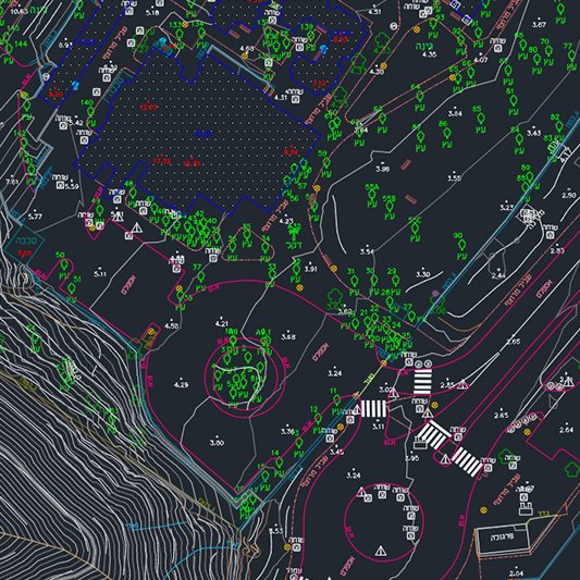
Multi-source layer integration, spatial analysis, and geospatial reporting across ArcGIS Proand QGIS. Enterprise geospatial data solutions for infrastructure, utility, and telecom network planning.
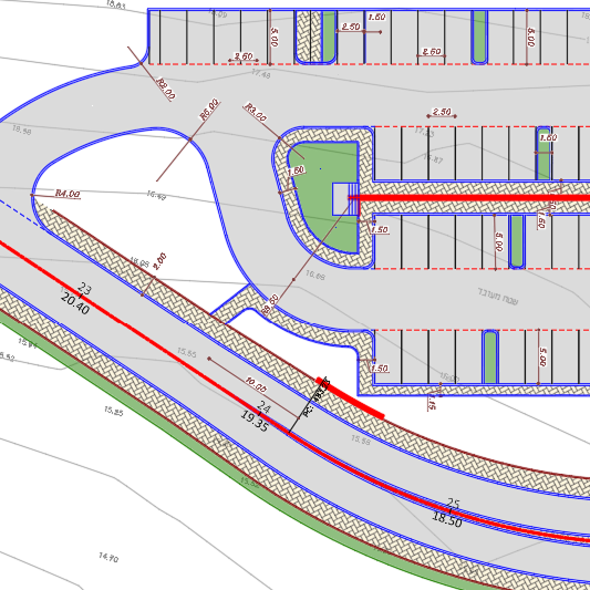
Road corridor digitalization, interchange mapping, utility network layer production, and topographic mapping at any required engineering scale. Map post-processing using client field data for permit-ready output.
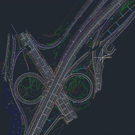
GIS database architecture, schema alignment, attribute standardization, and spatial data validation pipeline design. Our remote team integrates with your existing ArcGIS or QGISenvironment and data governance framework from day one.
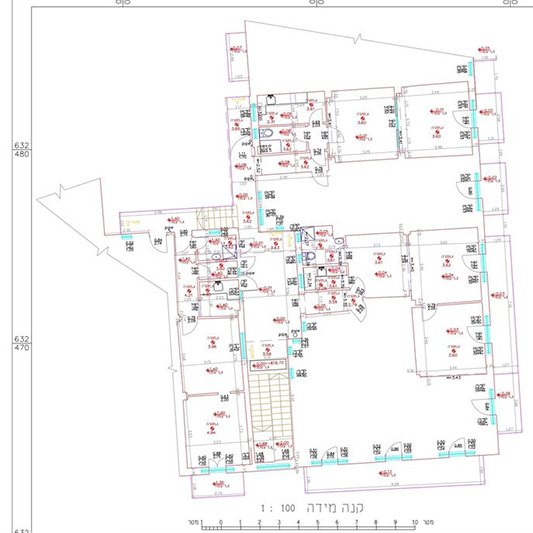
Precision 2D drafting, AutoCAD conversion, and technical drawing services produced from your survey or scan data. CAD outsourcing services integrated into your existing drawing standards, layer structure, and project filing conventions.
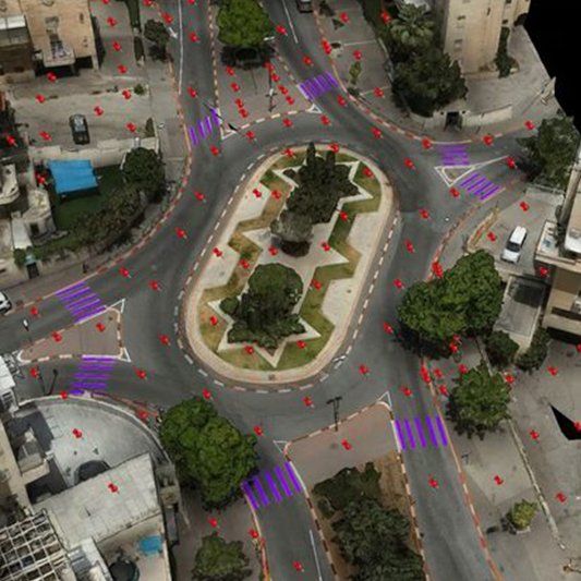
Point cloud to CAD conversion at any required scale. LiDAR and structured-light scan data processed through Leica Cyclone 3DR and ReCap to Civil 3D engineering drawings — entirely from your provided scan files.
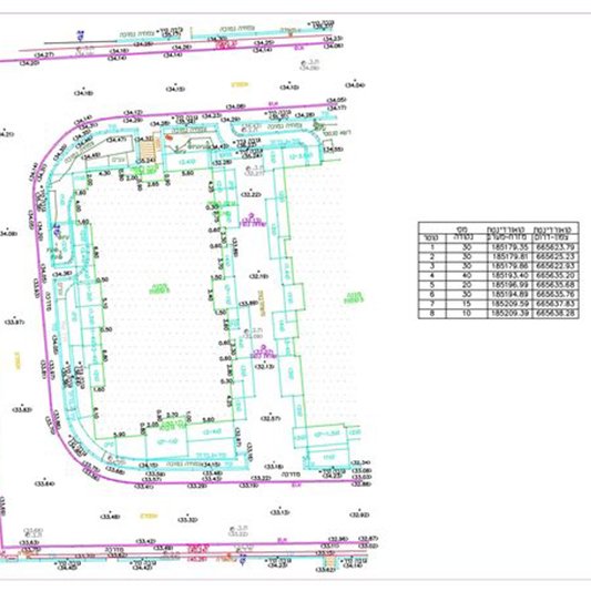
As-built CAD drawings, facade elevation plans, and interior floor plan drafting services from scan, survey, or LiDAR data. Construction-ready documentation with colour-coded layer structures and full dimension annotation — no field visits from our engineers.
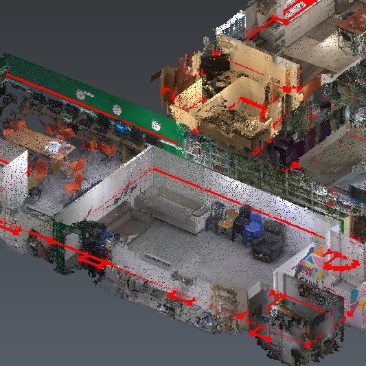
Point cloud to BIM model conversion for architectural, structural, and MEP disciplines. LiDAR and photogrammetry scan data processed through Leica Cyclone 3DR, ReCap, and Revit into LOD 200–400 building information models, entirely from your provided scan files.
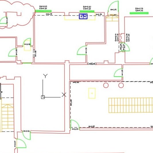
Full BIM modeling and coordination services in Revit and Navisworks, including architectural, structural, and MEP model creation, clash detection, and 4D/5D coordination. BIM outsourcing integrated into your existing standards, LOD requirements, and project workflow.
Road design and civil engineering drafting from survey, scan, or LiDAR data, including alignment, corridor modeling, cross-sections, and earthworks calculations produced in Civil 3D. Construction-ready road engineering documentation with full annotation — no field visits from our engineers.
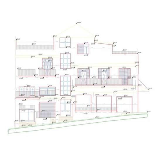
Complete format migration across Shapefile, GeoJSON, File GDB, DWG/DXF, KML, and LAS/LAZ via our GIS data conversion service. Coordinate system transformation, datum alignment, and schema mapping to NUAR, INSPIRE compliance standards.
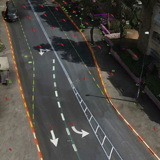
Drone imagery processed to ortho-mosaics, point clouds, and DEMs using Agisoft Metashape. UAV data processing and drone image processing services executed from your raw capture files — no flight planning or drone operations from GIS JOT.
Every sector has its own regulatory schemas, platform conventions, and data standards. Our engineers arrive pre-qualified in yours — with experience in the specific compliance outputs your sector requires.

Network GIS data services, fiber route digitization, utility asset management, and NUAR/INSPIRE-compliant schema build-out for energy grid and telecom operators. ArcGIS Pro and QGIS platforms. All data processed in the office from client-provided records.

BIM and GIS integration, as-built CAD documentation, point cloud to engineering drawings, and permit plan packages for AEC firms and infrastructure developers. Engineers work in your Revit, AutoCAD Civil 3D, or BIM/GIS hybrid stack from day one.

Pipeline corridor digitization, asset GIS registry, compliance mapping, and gis data migration between operator schemas for midstream and downstream energy operators across Europe and the Middle East. All processing is office-based from your supplied data.

Crop monitoring layer digitization, field boundary delineation, soil zone mapping, and drone agriculture image processing from client-supplied aerial and satellite imagery. QGIS-based analysis pipelines aligned to your agronomic output specification.
Our embedded approach gives you the control of an in-house gis consulting team with the economics of a specialist remote partner. Find your GIS engineer the same way you would onboard any senior engineer — directly into your tools, your data standards, and your sprint cycle.
Matched, onboarded, and producing validated output by week two. Not month six.
No equipment, licences, or HR overhead. Same output at a fraction of total employment cost.
Our AutoCAD and Civil 3D plugin suite cuts per-deliverable production time by 40–50%.
Every specialist is desk-based, processing data your field teams supply. No site operations.
One consultant for a sprint or a full team for a programme. Engagement tracks live demand.
One month of production work before commitment. Wrong match replaced at zero cost.
Our geospatial data services operate entirely within the office environment. Your field teams supply the raw spatial inputs; we structure, convert, validate, and return engineering-ready outputs.
Data security, software stacks, compliance standards, and the mechanics of our embedded engagement model — answered directly.
No. Every role is 100% office-based. We process data supplied by your field teams — LiDAR scans, drone captures, survey exports, CAD files, or legacy GIS archives. No surveying, no drone operations, no site attendance at any stage of the engagement.
ArcGIS Pro, QGIS, AutoCAD Civil 3D, Autodesk ReCap, Agisoft Metashape, Leica Cyclone 3DR, Skyline TerraExplorer, FME, and PostGIS — plus our proprietary JOT Plugin suite for Civil 3D automation. Engineers are matched to your specific stack before placement.
All engineers operate under NDAs and work exclusively within your access control environment. No client data is held, transferred, or archived outside your specified storage or project management system. GIS JOT maintains no copy of client spatial datasets.
Our teams have delivered datasets to NUAR (UK), INSPIRE (EU), MAVAT (Israel), and custom client schema requirements. Every schema compliance requirement is confirmed during data intake before processing begins — no assumptions are made about target standard.
Yes. We are actively hiring GIS analysts, AutoCAD Civil 3D and Revit specialists, photogrammetry engineers, and data pipeline specialists. All roles are 100% remote. Visit our GIS jobs page for current openings and application details.
Tell us your platform stack, delivery timeline, and whether you need an embedded GIS consultant or a fully managed project scope. We match you with the right specialist and have them operational inside your environment within 1–2 weeks. A GIS consultancy services model built for engineering firms — without the recruitment delays, infrastructure investment, or field overhead.
Remote embedded GIS engineering services for global infrastructure operators. Office-based post-processing, deployed in 1–2 weeks.
GET IN TOUCH
We’ll respond within 48 hours
ML-based feature extraction and automatic digitalisation for surveying.