
GIS Data Services
Format conversion, map digitizing services, coordinate transformation, CAD to GIS conversion, and geospatial data migration done across all common vector and raster formats. Remote delivery with full attribute QA included.
Estimate within 48 hours
1-month risk-free trial
Onboarding in 1–2 weeks
Common Pain Points
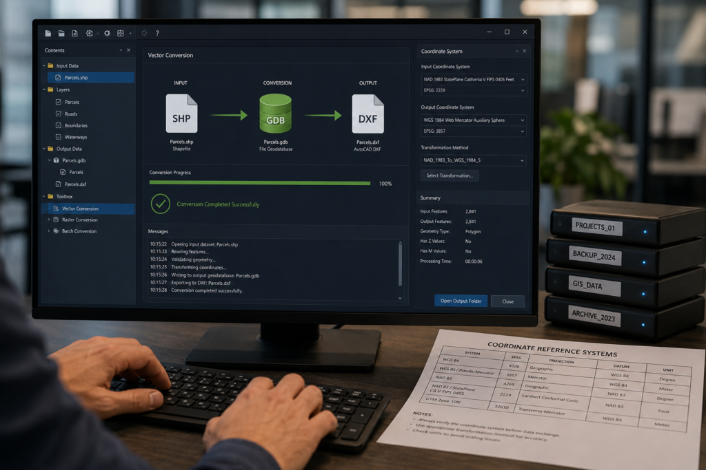
Engineering and GIS teams regularly face data conversion problems. Mismatched formats, broken geometries, lost attributes, and CRS conflicts can disrupt downstream workflows. Our GIS data conversion services resolve these issues cleanly and efficiently.
Incompatible Formats Across Teams
Survey delivers LAS, client wants GeoJSON, engineering works in DWG. Format fragmentation blocks data exchange and forces manual re-entry. Geospatial data conversion resolves this at scale.
Legacy Map Data That Can't Be Used
Scanned paper maps, raster PDFs, and georeferenced images contain valuable spatial information, but need digitizing services to become editable, queryable GIS layers.
Coordinate System Conflicts
Data from different sources arrives in different CRS — WGS84, ITM, local grids. Without accurate coordinate transformation, layers don't align and analysis produces errors.
CAD Data Incompatible with GIS
AutoCAD DWG files have no native attribute schema or CRS. CAD to GIS conversion requires feature extraction, geometry cleaning, attribute population, and projection alignment.
GIS Data Migration Breaks Schemas
Moving spatial data between platforms, ArcGIS to QGIS, Shapefile to GeoPackage, Access to PostGIS, often breaks attribute schemas and geometry validity without specialist handling.
Topology Errors After Conversion
Automated conversion tools produce geometry, but not validated geometry. Slivers, gaps, overlaps, and self-intersections introduced during conversion fail QA and block project delivery.
What We Do
Our GIS data conversion services cover the full process, from raw input to final output. We clean geometries, transform coordinates, map attribute schemas, and verify the final data through QA. The finished data is delivered in the format required by your downstream platform or client.
More Than Format Switching
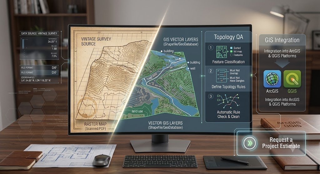
Automated conversion tools handle syntax, they don't handle meaning. When a DWG layer becomes a Shapefile, the geometry may transfer but the attribute schema, CRS definition, topology rules, and feature classification don't follow automatically. Our GIS data conversion services handle all of it: we map attributes, repair geometry, assign projections, and validate topology before the output file leaves our QA process.
From Raster to Vector GIS Layer
Map digitizing services convert raster source material, scanned paper maps, georeferenced images, aerial photography, or PDF plans, into fully attributed vector GIS layers. Each digitized feature is classified, attributed, and topologically validated. Output is delivered as Shapefile, GeoJSON, GeoPackage, or DWG depending on the downstream workflow.
Engineering Data into Spatial Analysis-Ready Layers
AutoCAD DWG and DXF files contain precise geometry but lack the attribute schema and CRS definition that GIS platforms require. Our CAD to GIS conversion service extracts features by layer, assigns attribute fields based on the feature classification, transforms the geometry to the required coordinate reference system, and validates topology. Producing a GIS-ready dataset from your engineering source files.
Platform-to-Platform Without Data Loss
Migrating spatial databases between platforms, Esri to open-source, legacy Shapefile archives to GeoPackage, Access geodatabases to PostGIS, requires careful schema mapping and geometry validation at every step. Our GIS data migration service handles the full process: schema translation, data type alignment, geometry repair, CRS standardisation, and post-migration QA to verify zero data loss.
Services Included
Six core GIS data conversion services;
From KML to Shapefile conversion and map digitization through CAD to GIS, coordinate transformation, and full platform migration.
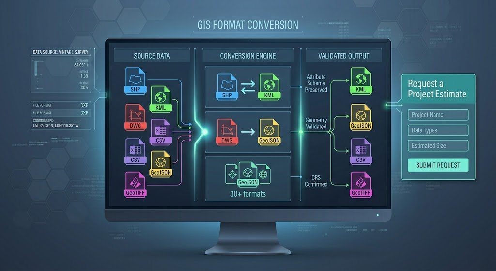
Vector and raster format conversion across all common geospatial formats; Shapefile, GeoJSON, GeoPackage, KML/KMZ, GeoTIFF, DWG, DXF, CSV, and more. Attribute schema preserved, geometry validated, CRS confirmed at output.
Raster-to-vector conversion of scanned maps, georeferenced images, aerial photography, and PDF plans into fully attributed GIS layers. Feature classification, topology rules, and attribute population included. Data digitization services for any source scale or complexity.
AutoCAD DWG and DXF conversion to GIS-ready vector formats. Features are extraction by layer, attribute schema assignment, coordinate transformation, and topology validation. AutoCAD to Shapefile conversion, DWG to GeoJSON, and DXF to GeoPackage all supported.
Accurate reprojection between coordinate reference systems; WGS84, Web Mercator, national grids (ITM, BNG, RD New, MGI), and custom local projections. Batch transformation across large datasets with point-sample verification at delivery.
Platform-to-platform geospatial data migration; Esri File Geodatabase to GeoPackage, Shapefile archives to PostGIS, ArcGIS Online to QGIS-compatible formats. Schema mapping, data type alignment, and post-migration QA included in every project.
Automated conversion output cleaned, validated, and certified; Slivers removed, gaps closed, self-intersections repaired, duplicate features eliminated, and attribute completeness confirmed. Topology rule sets applied per feature class before final delivery.
Automation Advantage
We don't rely solely on off-the-shelf software. To deliver services up to twice as fast as traditional geospatial data analysis companies, we utilize proprietary automation tooling that eliminates repetitive manual tasks from the production pipeline.
By automatically generating topographic maps directly from input survey codes, we pass the speed and cost benefits directly to you.
Custom GIS Plugins
Purpose-built extensions for ArcGIS Pro and QGIS that automate repetitive spatial processing tasks across large dataset batches.
J.O.T Complex Plugin
Handles complex topographic object classification and symbology generation directly from survey code inputs.
J.O.T AutoCAD AI Plugin
AI-assisted drafting layer that automatically generates compliant topographic maps from field data codes, no manual layer assignment required.
PROJECT EXAMPLES
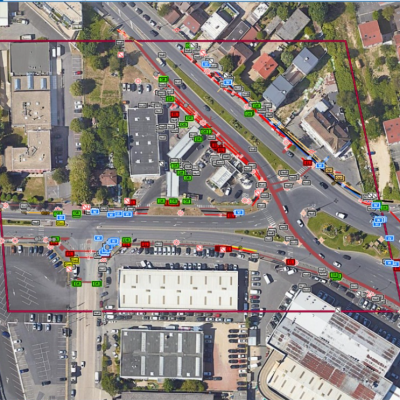
Selected outputs from completed engagements, spanning GIS data conversion, digitization, and format migration. Produced entirely from client-supplied source data.
Why GIS JOT
Online converters and scripts handle syntax. Our GIS data conversion services handle the whole problem from geometry, attributes, topology, CRS to QA and deliver a file you can actually use.
What You Receive
Every file from our GIS data conversion services is topology-valid, correctly projected, and attribute-complete. Accompanied by documentation confirming what was done and why.
Converted GIS Files
Output in your required format, Shapefile, GeoJSON, GeoPackage, KML, DWG, or any other target format, with CRS definition file (.prj) and attribute schema intact.
Digitized Vector Layers
Fully attributed vector GIS layers from raster, PDF, or paper source material. Also feature-classified, topology-validated and delivered in your required format and CRS.
Reprojected Datasets
Source data accurately transformed to your target coordinate reference system, with a point-sample verification table confirming transformation accuracy.
CAD-to-GIS Conversion Packages
GIS-ready layers extracted from DWG or DXF source files. Features schema documented, attributes populated, geometry validated, and delivered as Shapefile or GeoPackage.
Migrated Spatial Databases
Platform-migrated geodatabases with schema documentation, data type mapping record, and post-migration feature count and geometry validity confirmation.
QA Report
Conversion QA document covering: source format and CRS, target format and CRS, feature count before and after, geometry repairs applied, attribute schema changes, and validation pass/fail status.
Metadata Files
Each delivered layer includes ISO 19115-compatible metadata. This covers the format, CRS, extent, feature count, source data, and processing notes. The metadata is ready for import into your spatial data catalogue.
FAQ
Get Started
Send us your source files and receive a fixed-price estimate within 48 hours — with a firm delivery date and full topology QA included as standard on every project.
Remote embedded GIS engineering services for global infrastructure operators. Office-based post-processing, deployed in 1–2 weeks.
GET IN TOUCH
We’ll respond within 48 hours