Drone & UAV Data Processing
Drone image processing, orthomosaic production, DEM generation, and point cloud analysis from your UAV or aerial imagery. Office-based processing with engineering-grade output, delivered remotely.
You fly — we process
GCP-verified accuracy
Estimate within 48 hours
Common Pain Points
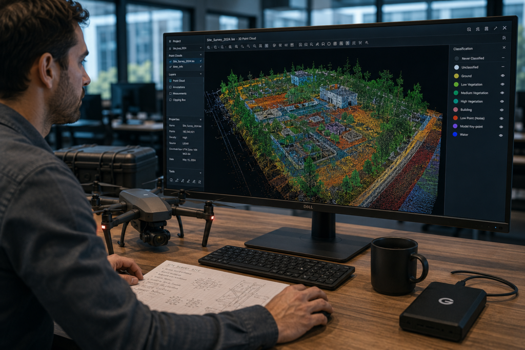
Drone operators and survey firms that capture UAV imagery regularly face the same bottleneck. The flight is complete and the data is collected, but processing it into usable orthomosaics, DEMs, and point clouds requires specialist software and time that most field teams do not have.
Raw Images, No Processed Output
Hundreds of drone images captured on site but no pipeline to process them into georeferenced orthomosaics, elevation models, or point clouds. Data ages while projects wait.
No Processing Hardware or Software
UAV data processing in Agisoft Metashape or Pix4D requires high-end workstations and software licences. Most field teams don't have the infrastructure for large-scale drone image processing in-house.
Accuracy Without GCPs
Processing drone imagery without ground control points can produce georeferenced output, but not necessarily survey-grade accuracy. Correctly integrating GCPs into the photogrammetry workflow requires specialist knowledge.
No Downstream CAD or GIS Output
Photogrammetry processing produces rasters and point clouds, but clients often need contour lines, volume calculations, or as-built CAD drawings. These require additional processing that many operators do not have the capacity to provide.
Processing Backlog at Peak Season
Survey firms flying multiple sites simultaneously can produce more data than their processing teams can handle. In these situations, processing capacity becomes the limiting factor rather than flight hours.
Output Format Mismatch
Processed photogrammetry output in the wrong format or CRS is unusable for the client. Drone data processing services need to deliver in the format the downstream GIS or CAD workflow actually requires.
What We Do
We are an office-based photogrammetry processing team. We do not operate drones or conduct aerial surveys. You capture the imagery, and we process it into georeferenced orthomosaics, digital elevation models, dense point clouds, and downstream GIS and CAD outputs.
From Raw Images to Georeferenced Deliverables
Aerial photogrammetry services cover the full post-capture processing pipeline, including image quality assessment, alignment and tie-point generation, dense point cloud reconstruction, orthomosaic generation, DEM and DSM production, and delivery in your required format and coordinate reference system. Our commercial photogrammetry services support datasets from a wide range of UAV platforms, including DJI, senseFly, WingtraOne, Parrot, and custom fixed-wing systems.
Survey-Grade Accuracy from Your Flight Data
UAV data processing accuracy depends on image overlap, GCP distribution, and flight altitude. We assess your dataset before processing begins and advise on achievable accuracy. With well-distributed GCPs and adequate overlap (≥75% frontal, ≥60% lateral), our drone data processing pipelines consistently achieve 2–5cm GSD on orthomosaics and sub-5cm vertical accuracy on DEMs. All outputs include an accuracy report and residual analysis.
Services Included
Six photogrammetry processing services covering the full range of outputs, from orthomosaic and DEM production through point cloud analysis, volume quantification, and downstream CAD integration.
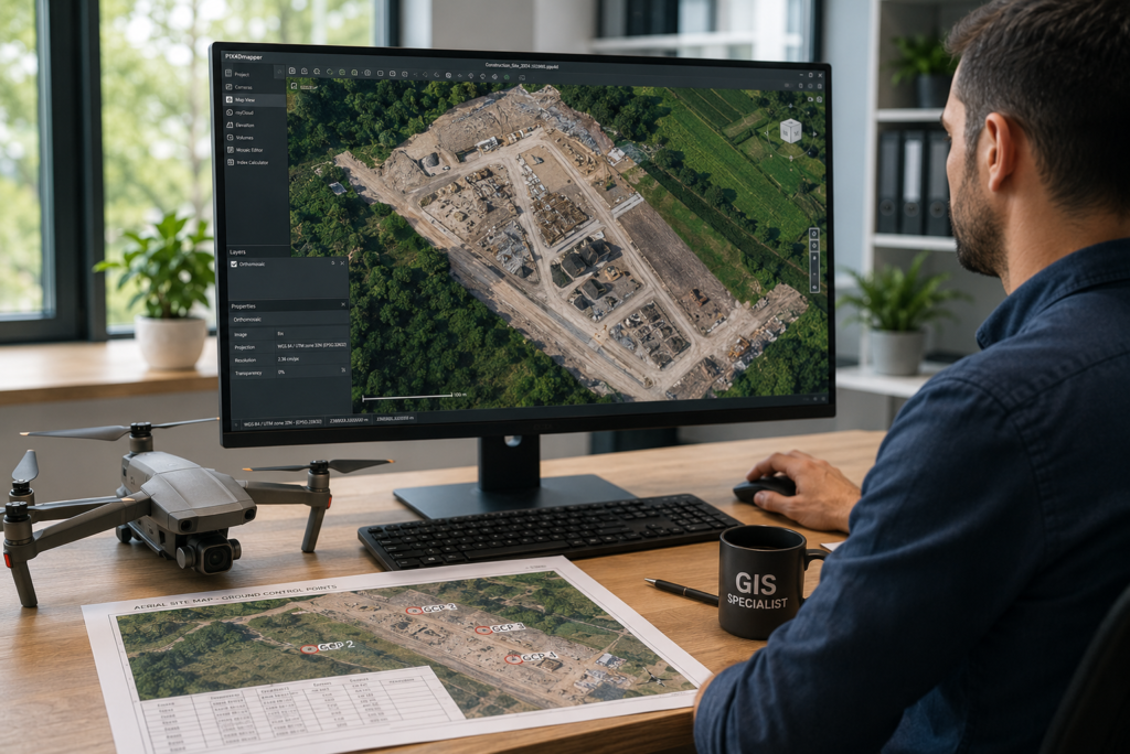
GCP-controlled orthomosaic generation from your drone imagery. Outputs are georeferenced, radiometrically corrected, and delivered in GeoTIFF at your required GSD and CRS. Suitable for base mapping, change detection, and GIS layer integration. UAV data processing includes a full accuracy report with residual analysis.
Digital elevation model and digital surface model production from drone imagery or LiDAR-integrated UAV datasets — with contour line generation, slope and aspect analysis, and volume surface preparation. Output in GeoTIFF and Civil 3D-compatible surface format.
Dense point cloud reconstruction from drone imagery using structure-from-motion photogrammetry — classified, filtered, and output in LAS/LAZ or E57. Point cloud analysis includes ground classification, noise removal, and density reporting. Ready for downstream scan-to-CAD workflows.
Textured 3D mesh generation from UAV imagery for visual inspection, heritage documentation, and presentation purposes. Outputs are available in OBJ, FBX, or 3D Tiles format. Digital photogrammetry services include model quality assessment and texture resolution optimization for the intended use.
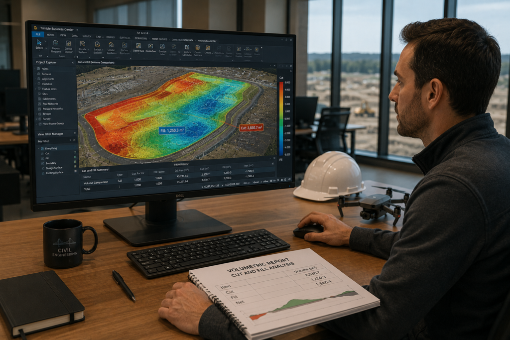
Cut-and-fill volume calculations, stockpile measurements, and earthwork quantification from UAV survey data. We use surface-to-surface comparisons against a reference plane or baseline DEM. Results depend on the quality of the input dataset, with uncertainty bounds reported.
Downstream conversion of photogrammetric outputs into engineering deliverables, including topographic CAD plans from DEMs, as-built drawings from point clouds, and GIS vector layers from orthomosaics. Our UAV photogrammetry services bridge the gap between data capture and engineering production.
From Processed Data to Engineering Output
Most photogrammetry services stop at the raster or point cloud stage. However, the engineering deliverable your client needs may be a topographic plan, contour map, or volumetric report in DWG format. These outputs require an additional specialist step. Our JOT Complex Plugin automates the conversion of processed DEM and point cloud data into drafted topographic CAD plans, removing the manual work between photogrammetric processing and engineering-ready drawings.
For recurring drone data processing projects, we build project-specific pipelines that batch-process new image sets and generate standardized outputs automatically. Each new flight can then produce deliverables using the same format, CRS, and layer structure as previous projects.
J.O.T Complex Plugin
AutoCAD and Civil 3D automation for photogrammetry-to-CAD workflows, including automated contour generation from DEMs, topographic symbol placement from classified point clouds, and bulk attribute management across large drawing sets.
J.O.T AutoCAD AI Plugin
Generate AutoCAD commands and scripts from plain-language instructions to accelerate repetitive steps when converting processed UAV data into engineering drawings. Works in multiple languages.
Custom Processing Pipelines
Python and PDAL pipelines for batch drone data processing, including point cloud classification, DEM generation, contour extraction, and GIS integration. The workflow can be automated end to end for recurring survey programs.
Why GIS JOT
Drone operators and survey firms that process data in-house face recurring capacity, software, and delivery format challenges. Our drone data processing services resolve them without capital investment.
What You Receive
Every output from our UAV data processing services is accuracy-verified, correctly projected, and formatted for direct use in your GIS, CAD, or reporting workflow.
Georeferenced Orthomosaic (GeoTIFF)
GCP-controlled orthomosaic at your required GSD and CRS. Outputs are radiometrically corrected, seamlessly mosaicked, and ready for GIS integration or base map production.
Digital Elevation Model (GeoTIFF)
DEM and DSM at your required resolution, suitable for contour generation, slope analysis, volume calculation, and Civil 3D surface import.
Classified Point Cloud (LAS/LAZ)
Dense point clouds classified by ground, vegetation, and structure. Data is noise-filtered, thinned to the required density, and prepared for downstream scan-to-CAD workflows.
Contour Lines (DWG / SHP)
Contour lines extracted from the DEM at your specified interval. Outputs are delivered in AutoCAD DWG or Shapefile format, with elevation attributes attached to every feature.
Volume & Accuracy Reports
Cut-and-fill or stockpile volume calculations where included in scope, plus a full accuracy report with GCP residuals, checkpoint RMSE, and processing quality metrics.
Topographic CAD Plan (DWG)
Where CAD output is included: a topographic plan with contour lines, spot heights, and layer structure produced in AutoCAD or Civil 3D from the processed DEM and point cloud.
Processing Log & Metadata
Full processing report documenting the software version, processing parameters, GCP list, accuracy summary, and output file inventory. The report is provided for client records and QA sign-off.
FAQ
Get Started
Send us your image set and GCP data and receive a fixed-price processing estimate within 48 hours — with a firm delivery schedule and full accuracy QA included as standard.
Remote embedded GIS engineering services for global infrastructure operators. Office-based post-processing, deployed in 1–2 weeks.
GET IN TOUCH
We’ll respond within 48 hours