
CAD Documentation Services
Floor plan drafting, architectural elevation drawings, and as-built drawing services from LiDAR scans, structured-light scan data, or field surveys. Remote delivery with engineering-grade accuracy and native DWG output.
Estimate within 48 hours
1-month risk-free trial
Onboarding in 1–2 weeks
Common Pain Points
Architects, contractors, and facilities managers regularly face the same bottleneck: scan data exists, but producing accurate as-built drawings from it requires specialist skill and tools that most teams don't have in-house.
Scan Data Without a Drawing Team
LiDAR or structured-light scans collected on site but no one available to convert them into as-built CAD drawings. The data sits unused while the project waits.
No Record of What Was Built
Design drawings rarely match what was actually constructed. Without accurate as-built documentation, renovation, permitting, and facilities management all work from assumptions.
Inaccurate Legacy Plans
Existing floor plans are years old and no longer reflect the building as it stands. New as-built drawings are needed but the team has no capacity to produce them from current survey data.
Permit Deadline Pressure
As-built drawings for planning authority submission are required urgently. Floor plan drafting services that can start immediately and deliver to a fixed schedule are difficult to find.
Wrong Scale or Layer Standard
As-built CAD drawings from previous providers may use incorrect scales, inconsistent layer naming, or missing CRS information. This can make them incompatible with your engineering workflow.
Complex Facades or Sloped Terrain
Architectural elevation drawings for buildings with non-standard geometry, such as sloped terrain, complex facades, or mixed-use structures, require specialist drafting skills that generalist CAD teams may not have.
What We Do
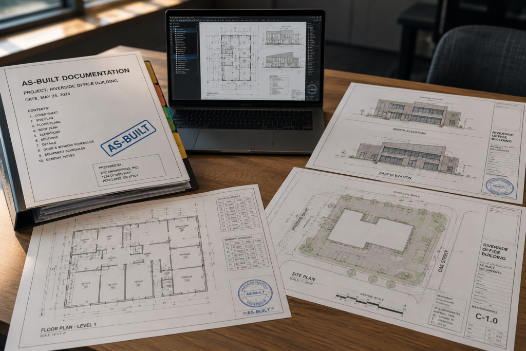
As-built drawings document a building or structure as it actually exists, rather than how it was originally designed. We produce as-built CAD drawings, floor plans, and architectural elevations from LiDAR scans, structured-light scan data, and field survey information provided by your team.
Design Intent vs. What Was Built
Design drawings show what was planned. As-built drawings show what was actually constructed, including installation changes, deviations from the original design, and features added after completion. As-built documentation is used for permitting, renovation, facilities management, property transactions, and insurance. Our services produce CAD-accurate documentation that reflects the structure as it exists at the time of survey.
We Process — You Supply the Scan or Survey
We are a remote, office-based as-built drawing team and do not conduct on-site scanning or measurements. You provide the source data, including LiDAR point clouds, structured-light scan files from Leica BLK, Matterport, or Artec, field survey measurements, or annotated photographs. We produce the as-built CAD drawings as a direct extension of your survey or scanning workflow.
Interior Layouts to Construction-Ready Plans
Floor plan drafting services cover a wide range of interior layouts, including architectural floor plans with room dimensions and areas, reflected ceiling plans, structural grid overlays, and MEP layouts. We produce floor plans at 1:50–1:100 for architectural use and at 1:20 for detailed interior documentation. All drawings are delivered in native AutoCAD DWG format and matched to your template, layer standards, and title block.
Facade Documentation to Submission Standard
Our architectural elevation drawings are produced from scan or photogrammetric data at 1:50–1:100. Drawings can be colour-coded by element type, including glazing, structure, and cladding, with accurate elevation markers, window and door dimensions, sill and lintel levels, and material annotations. Elevation drawings from survey data are suitable for planning authority submissions, renovation tendering, and facade refurbishment documentation.
Services Included
Six as-built drawing services covering a full range of outputs, from interior floor plans and facade elevations to point cloud as-built conversion and permit documentation packages.
As-built floor plans from scan or survey data, including room layouts, wall thicknesses, door and window schedules, room areas, and structural grids. Floor plans are produced at 1:50–1:100 in native AutoCAD DWG format using your layer standards.
Point cloud to as-built drawings using raw LiDAR or structured-light scan data, processed into CAD drawings at the required scale. Scan-to-CAD as-built conversion covers floor plans, sections, elevations, and site plans from a single scan dataset.
Complete as-built documentation for handover, permitting, and facilities management. Full drawing packages include floor plans, elevations, sections, and site plans compiled to your required document format and submission standards.
Architectural elevation drawings from facade scans or photogrammetric data, with colour coding by element type, elevation markers, window and door dimensions, and sill and lintel levels. Suitable for planning submissions and refurbishment tendering.
Site-level as-built drawings from LiDAR or drone survey data, including site layouts, external elevations, drainage and utility positioning, and boundary definition. Elevation drawings are produced at 1:100–1:500 for planning authority or contractor submission.
Building section drawings and cross-sections extracted from point cloud or survey data. Structural elements, floor-to-floor heights, ceiling profiles, and underground features are shown in full CAD detail at the specified scale.
Technology Stack
Our as-built drawing team handles the full scan-to-CAD workflow, from point cloud registration and feature extraction to final DWG delivery.
Scan Registration
Point cloud registration and cleaning from LiDAR, BLK, and structured-light scan files before as-built extraction.
Autodesk ReCap
Leica Cyclone
Feature Extraction
Extracting walls, floors, openings, and facade elements from point cloud data for as-built CAD drawings.
Cyclone 3DR
TerraExplorer
CAD Drafting
Floor plan drafting, architectural elevation drawings, and section drawing production, all delivered using your DWG template and layer standards.
AutoCAD
Civil 3D
Photogrammetric Input
Photogrammetric point cloud generation from drone or photo sets for elevation drawings from survey image data.
Agisoft
RealityCapture
BIM Output
Where as-built drawings need to accompany a BIM model, Revit as-built modeling is available alongside 2D CAD drawing production
Autodesk Revit
PROJECT EXAMPLES
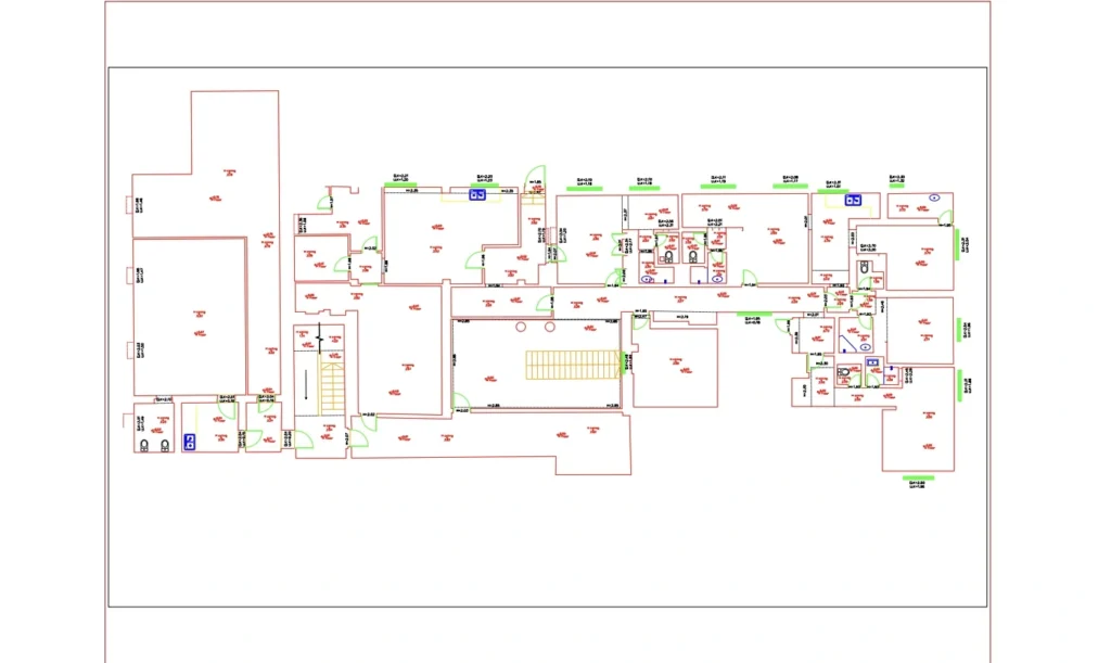
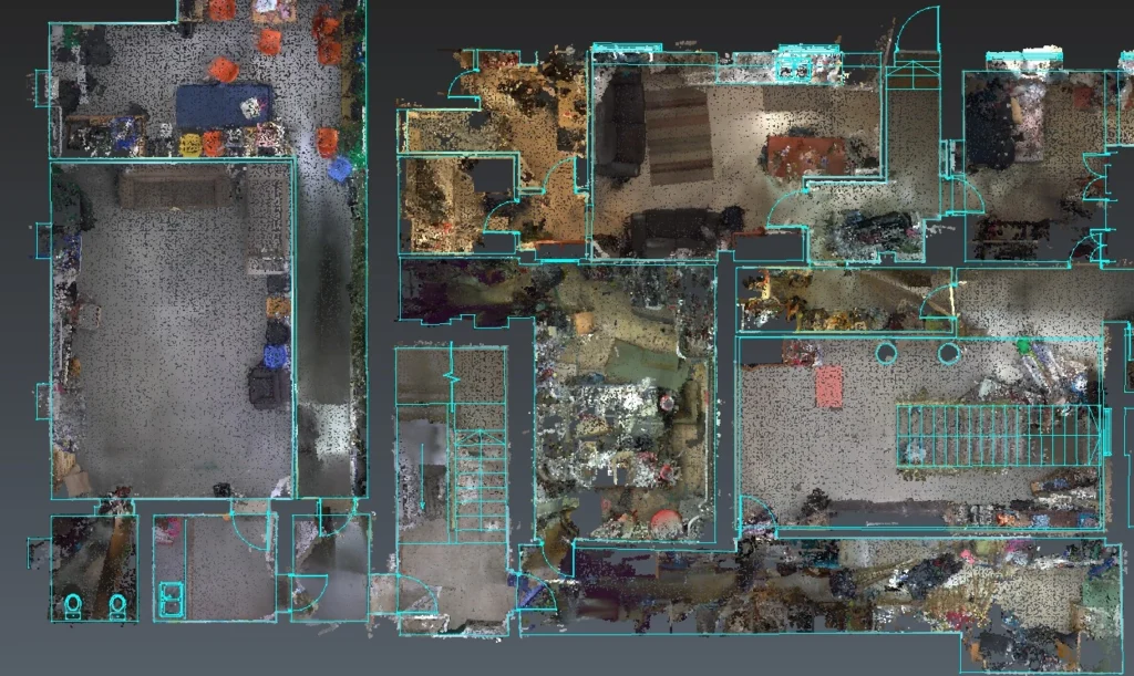
Selected outputs from completed projects covering topographic mapping, CAD conversion, and 3D reconstruction. All work was produced from client-supplied data.
Why GIS J.O.T
As-built documentation from scan data requires specialist skills, not just general CAD drafting. The difference is reflected in accuracy, compliance, and turnaround time.
What You Receive
Every drawing from our as-built drawing services is geometrically verified, layer-compliant, and formatted to drop directly into your engineering, permitting, or facilities workflow.
As-Built Floor Plans (DWG)
Fully dimensioned interior floor plans in native AutoCAD format, including room layouts, wall thicknesses, door and window positions, floor areas, and structural grids. Drawings are produced at your required scale and in your DWG template.
Architectural Elevation Drawings (DWG)
Facade elevations colour-coded by element type, including glazing, structure, and cladding. Drawings include elevation markers, window dimensions, sill and lintel levels, and material annotations.
Section & Cross-Section Drawings
Building sections through specified cut planes showing floor-to-floor heights, structural elements, ceiling profiles, and below-ground features.
Plot-Ready PDFs
Print-configured PDFs at your specified paper size and scale, ready for client review, site use, or planning authority submission without further formatting.
Permit-Ready Documentation Package
Construction documentation development services and government-compliant drawing packages, including north arrows, legends, scale bars, main text, and grids. Drawings are formatted for planning or building permit submissions.
Geometric Verification Report
Sample dimension comparisons between the source point cloud and delivered CAD drawings, confirming measurement accuracy at key elements across each drawing.
Revision Round Included
One full revision cycle included on every fixed-price project. Comments incorporated and redelivered within the agreed schedule at no additional cost.
FAQ
Get Started
Send us your scan files or survey data and receive a fixed-price estimate within 48 hours — with a firm delivery schedule and geometric QA included on every drawing package.
Remote embedded GIS engineering services for global infrastructure operators. Office-based post-processing, deployed in 1–2 weeks.
GET IN TOUCH
We’ll respond within 48 hours